Country Information - Islamic Republic of Pakistan اسلامی جمہوریۂ پاکستان(Part 7)
Islamabad - The Capital City
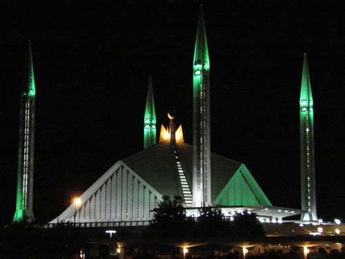
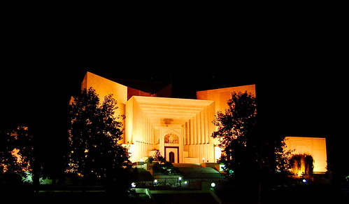
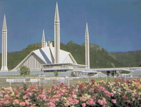
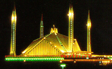
Left: The Beautiful Faisal Mosque (Photo Courtesy Jalalspages) - Right: The Supreme Court of Pakistan (Photo Courtesy: friend_faraway back home)
![]() At the time of independence, Karachi was chosen as the capital of Pakistan. However, after assuming the reins of the government, President Muhammad Ayub Khan decided to develop a new capital for the country, which should portray the natural beauty and and aspirations of the people of Pakistan. A site north of Rawalpindi was chosen to be named as Islamabad and the new capital city of the country. Rawalpindi was designated as the temporary capital. In 1959 the site of Islamabad was chosen to replace Karachi as the capital of Pakistan. The master plan of this modern city was prepared in 1960 by M/s. Constantinos A Doxiades, a Greek firm of Architects. Construction was started in October 1961, and the city came into life on 26 October, 1966, when the first office building of Islamabad was occupied. In 1967 Islamabad was officially made the capital, and work on the city's principal buildings, streets, and facilities was completed by the mid-1970s.
At the time of independence, Karachi was chosen as the capital of Pakistan. However, after assuming the reins of the government, President Muhammad Ayub Khan decided to develop a new capital for the country, which should portray the natural beauty and and aspirations of the people of Pakistan. A site north of Rawalpindi was chosen to be named as Islamabad and the new capital city of the country. Rawalpindi was designated as the temporary capital. In 1959 the site of Islamabad was chosen to replace Karachi as the capital of Pakistan. The master plan of this modern city was prepared in 1960 by M/s. Constantinos A Doxiades, a Greek firm of Architects. Construction was started in October 1961, and the city came into life on 26 October, 1966, when the first office building of Islamabad was occupied. In 1967 Islamabad was officially made the capital, and work on the city's principal buildings, streets, and facilities was completed by the mid-1970s.
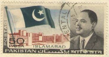
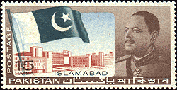
A set of two commemorative stamps was issued by the Pakistan Post to mark the occasion in the history of Pakistan. The stamps bore the diagram of Islamabad Secretariat in the background, with Pakistani national flag on its left and the photograph of then president of Pakistan, Muhammad Ayub Khan, who conceived the idea of Islamabad and finally got it built in six years.
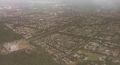
Covering an area of 351 square miles, Islamabad lies in an open, undulating area of Potwar (spelt "Po-tho-haar in local language) Plateau. The site is a panoramic expanse of natural terraces and meadows, rising from 1,700 to 2,000 feet above sea level. The lofty, lush green Murree Hills offer a very pleasant setting. Nearby towards the west, lie the historic ruins of fabled Taxila, cradle of the celebrated Gandhara civilization. Islamabad, having the most agreeable year-round climate and four definite seasons, has been located in proximity to the existing Rawalpindi city with all its services and facilities. Rawalpindi is on the main line of the Pakistan Western Railway. It is also serviced by modern airlines.
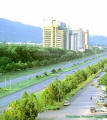
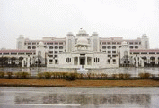
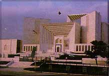
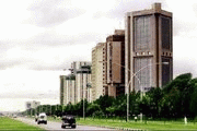
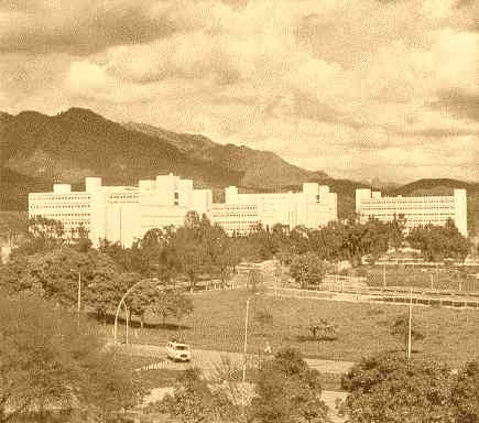
Located at the foothills of the Margalla mountains, Islamabad is a thriving modern and well-organized city. The city is very green due to the city's climate. There is also much wildlife in the north in the Margallas, which have been turned into a national park. The city is a fine blend of modern and traditional architecture, of which the Saudi-Pak Tower (above left) is a good example. The city is home to the Faisal Mosque, which is well known for its unique architecture and immense size. Numerous government buildings such as the National Assembly building, Convention Centre, the Presidency, Prime Minister's Secretariat (above centre), the Supreme Court (above second from right) and the Islamabad Secretariat are located at the foothills of Margallas. The palatial PM's secretariat, constructed at the Constitution Avenue with a total cost of one billion rupees, was handed over to Prime Minister Sharif on 14 August 1997, the occasion of the 50th anniversary of Pakistan. The work on the building, spread over an area of 40,000 square meters, was started in 1993 during the Benazir Bhutto term of premiership. The Secretariat Blocks are the administrative and policy planning nerve center of the country. These four to six storied buildings cover an area of 92,900 square meters. The Aiwan-e-Sadar (Presidency) is the official residence of the Head of State. The site is spread over an area of 20 acres, with the buildings covering over 30,000 square meters. The Parliament building is 5 stories tall, and includes both Houses of Parliament with a built up area of over 55,000 square meter including offices, committee rooms, libraries and cafeterias. Almost all foreign embassies are located in the Diplomatic Enclave, close to government buildings off the Constitution Avenue. The city also houses the Quaid-e-Azam University. Blue Area (above right) is the main business centre of Islamabad.
Left: The monument in Fatima Jinnah Park ( Photo Courtesy Jalalspages ) - Right: Islamabad by Night (Photo Courtesy: friend_faraway-back home )
The city is divided into eight largely self-contained zones, each characterized by its predominant usages (such as for government, the diplomatic enclave, the commercial district, the educational sector, the industrial area, commerce, light industry, residential areas and so on) each with its own shopping area and park. It is a modern and carefully planned city. There are ample opportunities for walking, jogging, hiking and trekking around Islamabad in the Margalla Hills range, which offers excellent opportunities for short and long hikes with magnificent vistas opening up on all sides. A network of trails having more then 120 kilometres total length has been developed.
The National Monument at night (Photo Courtesy Jalalspages )
The National Monument atop Shakarparian Hills in Islamabad, is a spectacular monument that represents the four provinces and three territories of Pakistan. The structure comprises four blossoming flower petals, built of granite, representing the unity of Pakistani people. From air the monument looks like a star (center) and a crescent moon (formed by walls forming the petals), these represent the star and crescent on Pakistan's flag. The blooming flower shape of the monument represents Pakistan's progress as a rapidly developing country. The four main petals of the monument represent the four provinces (Balochistan, North West Frontier Province, Punjab, and Sindh), while the three smaller petals represent the Northern Areas, Azad Kashmir and the Federally Administered Tribal Areas. The Monument has been designed to reflect the culture and civilization of the country and depicts the story of the Pakistan Movement, dedicated to those who sacrificed themselves for future generations. The inner walls of the petals are decorated with murals. The central platform is made in the shape of a five-pointed star which is surrounded by a water body. A metallic crescent surrounding the star is inscribed with sayings of Muhammad Ali Jinnah and poetry of Allama Iqbal.
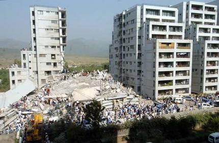
Secretariat Complex (left) - Devastated Margalla Towers (right)
Mragalla Towers, one of the multi storey buildings in the posh area of Islamabad, crumbled like a pack of cards on 8 October 2005 when a powerful earthquake that jolted most part of the Pakistan's northern areas. ISLAMABAD PICTORIAL

The Japanese Park Faisal Mosque The Shakarparian Hills 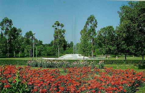
The Exotic Rose and Jasmine Garden Faisal Mosque by Night The Supreme Court of Pakistan
In order to conserve the rich history of Pakistan and its culture, a number of museums have been established in Islamabad. These museums are aesthetically laid out to narrate the story of Pakistan, its past, present and future aspirations, its people and its rich cultural heritage. These museums include:-
Exterior of Lok Virsa Museum (Photo Courtesy: friend_faraway-back home )
-
Folk Heritage Museum established by the The Lok Virsa (National Institute of Folk and Traditional Heritage) is located near Shakarparian Hills and has a large display of embroidered costumes, jewellery, woodwork, metalwork, block printing, ivory and bone work. The Lok Virsa is working towards preserving the living folk and traditional culture of Pakistan. The museum in our traditional architecture facades exhibits skills as fresco, mirror work, marble inlay, tile mosaic and stucco tracery. Lok Virsa Heritage Reference Library is equipped with resource data on ethnography, anthropology, folk music, art, history and crafts.
-
The Museum of Natural History is located opposite the Women's College on College Road in F-7/2, Commercial Area. The Museum depicts early human history, geology, and wildlife of Pakistan. the exhibits are particular interest to students and children.
- Islamabad museum presents a long historic sequence of the land where Pakistan is situated today. Pakistan has been a seat of the worlds leading civilizations from the time immemorial. There is plenty of evidence to support this argument now on display in Islamabad Museum. For example, 20 million years old fossil remains, 2 million years old man-made stone tools, 7000 years old early human settlements which lead to the world famous Indus Civilization, Gandhara Grave Culture and Gandhara art, early Islamic settlement and Mughal period, their art and craft.
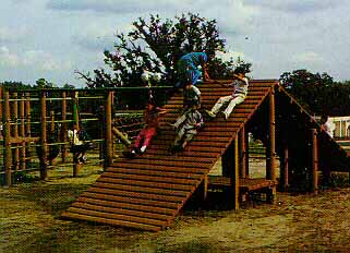
Islamabad has many view points and gardens that add to the beauty of this city abound in natural landscape. To start with, one should see Islamabad from Shakarparian Hills followed by Daman-e-Koh. Shakarparian Hills are located near Zero Point, at a height of 609 meters. Its terraced garden offers pleasant and sweeping vistas of Margalla and Murree hills, Rawal Lake, Rawalpindi Islamabad. Rose/jasmine garden located at the back foot hills of Shakarparian is an exotic garden spread over an area of 20,360 square meters and is famous for end less verities of roses. To be exact, it has 250 different varieties of roses as well as a dozen types of Jasmines. Flower shows are occasionally held here, particularly during spring. There also is a Tourist Camping Site. Daman-e-Koh is a low hill over looking Islamabad, offers panoramic view of Islamabad, specially at night. The place is ideal for afternoon and evening outing with family and friends. Marghzar Mini Zoo is located at the foot of Daman-e-Koh view point. A display corner of Pakistan Museum of Natural History and a Japanese style children's park have also been established near the Zoo. The Park is a gift to Pakistani children from the children of Japan.
There is a shrine of a great saint Hazrat Shah Abdul Latif Kazmi, popularly known as Bari Imam in the village of Nurpur Shahan situated at the foot of Margalla Hills, near Quaid-e-Azam University. The shrine is famous for the mirror-studded structure, originally built on the order of Mughal emperor Aurangzeb. The death anniversary (Urs) of Bari Imam is observed in the first week of May beginning Monday through Thursday with lot of festivities representing the Potohar culture and attracts people from all over the country. This is an overview of the renovated Said Pur village near Islamabad - Pakistan. The old village has been uplifted to add an attraction to the tourists visiting the place. For details on the village and its renovation plans/activities, please read my blog at: http://jalalspages55.blogspot.com/
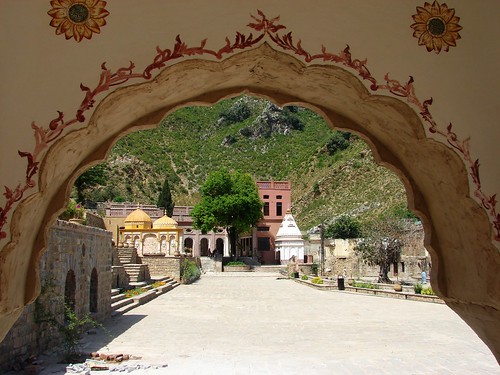
The renovated view of Said Pur Village (Photo Courtesy Jalalspages)
The shrine of Syed Meher Ali Shah of Golra Sharif is located 18 km from Rawalpindi, in sector E-11 of Islamabad. He was descendant of Syed Abdul Qadir Gilani of Baghdad. He was preached and spread the message of Islam during the turbulent times in South Asia.
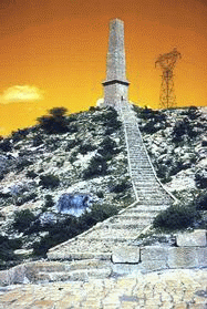 Around Islamabad, there are many places to visit. The Margalla pass is located 26 km west of Islamabad on Grand Trunk Road, which has been mentioned by historians and emperors like Alberuni, Farishta and Jahangir. The pass in fact is a link between the ancient capital of Gandhara (Taxila) and the modern capital of Pakistan. There is an obelisk right on the top of the Pass, built in 1890 in memory of Brigadier General Sir John Nicholson (died on 23 September 1857 in Delhi) of British army for his achievements in the expeditions to Afghanistan. A small part of the ancient Shahi (Royal) Road can be seen just across the pass, left of Grand Trunk Road. This road was first built by the Persians in 516 BC and later developed by the Afghan King Sher Shah Suri in 1540s. An inscription on the western side of this stone pavement shows that it was again repaired in 1672 AD.
On the main Grand Trunk Road are also remains of the once famous Wah Gardens, located 12 km west of Taxila. The gardens were developed with magnificent trees and weather channels by successive Mughal emperors. Tapering cypress trees line the canals through which cool waters once, Flowed between elegant romantic and cascading into large reflecting basins. The gardens are being restored to their original beauty, by the Department of Archaeology, Government of Pakistan.
Khyber Pakhtunkhwa
The Northern Gateway
 Khyber Pakhtunkhwa (the erstwhile famous NWFP) is the frontier province of Pakistan located in the north west adjacent to Punjab in the west, Balochistan in the south, northern areas in the north and shares a 1,100 km long border with Afghanistan to the west. Peshawar is its capital, and the Vale of Peshawar, fertile and well watered by the Kabul and Swat rivers, is its heart. This was also the heart of the ancient kingdom of Gandhara and is rich in archaeological remains. The northern half of the province consists of five river valleys running roughly parallel, north to south: the Chitral, Dir, Swat, Indus and Kaghan. Northern Chitral and the upper regions of the Indus Valley are mountainous deserts, where cultivation depends entirely on irrigation. The Khyber Pakhtunkhwa south of Peshawar is below the monsoon belt and consists of low, rocky mountains and wide, gravelly plains.
The warlike Pathans (or Pushtuns or Pukhtuns), who live in Khyber Pakhtunkhwa and the adjoining areas of Afghanistan, number about 17 million, making themselves a race apart, a chosen people. The Pathans are divided into numerous sub-tribes and clans, each defending its territory and honour.
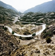
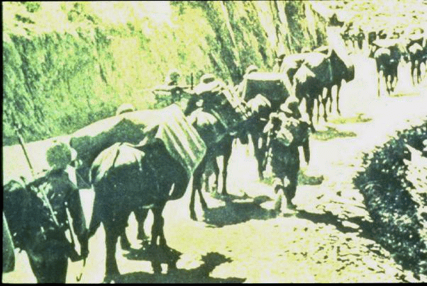
Khyber Pakhtunkhwa through its famous Khyber Pass (56 kilometres long, 40 kilometres being in Pakistan and the remainder in Afghanistan. From the Khyber border post at Torkham, where an old sign warns hitch-hikers that under no circumstances should they spend the night in the open in the Pass, it is a 55 kilometre journey to the city of Peshawar.) has been subjected to all northerly invasions from Alexander to Mahmud of Ghazna. Not until the powerful Kushans invaded Gandhara and pacified the area in the first century AD did the Khyber become a popular trade route. Sher Shah Suri, ran his Delhi-to-Kabul Shahi Road through the Khyber Pass.
The British left behind a number of mementos of their long stay in the Khyber. The road itself is the most enduring, while the weathered and faded insignia and crests of famous regiments carved into the walls of the Pass are eye catching. There is a railway too, dating back to the mid 1920s. The sight of the steam train which, once a week on Fridays, runs up from Peshawar to Landi Kotal, reinforces the sense that one has of the Khyber Pass being outside the normal processes of time. The train has an engine at either end-both were made in England in I931.
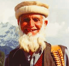
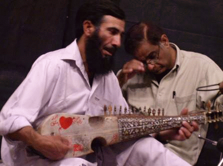
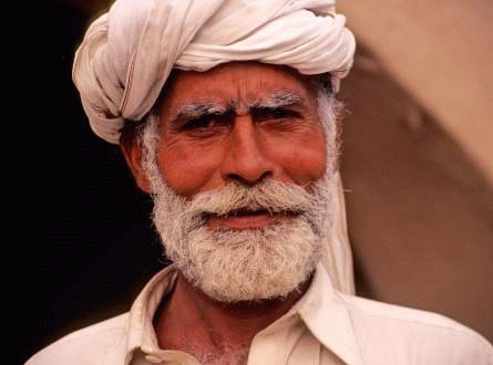
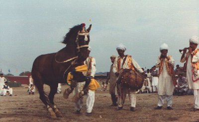
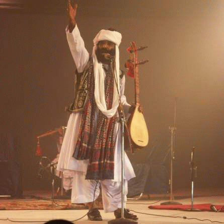
The Pathans (the majority people in Khyber Pakhtunkhwa) are stout, broadly built and clad in traditional baggy trousers and long loose shirts (Shalwar and Kameez) encounter guests with a firm hand-clasp and a straight but friendly look. They often wear bullet studded bandoleers across their chests or pistols at their sides more of a tradition and less of a display of armoury or show of power. They display their emotions too quickly, which may take an onlooker by surprise. On weddings and occasions of joy, salvos of gun fire are amusing. Rabab is their traditional stringed musical instrument, which adds rhythms to the beautiful Pashto poetry.
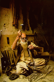
Darra Adam Khel in the tribal area near Kohat has been an ancient indigenous weapons manufacturing village since ages. Here one could find hand made fire arms from simple shot guns to automatic rifles and pistols. The arms manufacturing "factories" produced weapons which is considered to be the jewelry of Pathans of the tribal areas. Lately, the government of Pakistan has patronized these small factories for exporting the hand made weapons for those who love hunting with hand made classic guns. One only need to try these indigenous rifles to appreciate the craftsmanship of totally illiterate craftsmen.
In recent times, the province is embattled into a fierce War on Terror as the militants from adjoining war torn Afghanistan infiltrate from a largely porous border between Pakistan and Afghanistan. Now these militants have even started to threaten the law and order situation inside Pakistan. There have been hundreds of suicide bomb attacks by these very militants causing casualties in thousands. Pakistan Army has played a leading role in containing and defeating the militants and clearing out many cities that have fallen to the active influence of the militants.
In 2010, the name of the province was changed from the erstwhile NWFP (North Western Frontier Province - a name coined by the British) to Khyber Pakhtunkhwa. Protests arose among the local ethnic Hazara population due to this name change, as they began to demand their own province.
Besides the ill effects of war on terror, the province has been hit hard twice by severe natural calamities in the past five years. While it was still recovering from the after shocks of one of the most severe earthquakes of the world that left thousands dead in 2005, the flash floods in July-August 2010 have devastated not only Khyber Pakhtunkhwa but the entire Pakistan. Till updating this page, Pakistan and its people continue to face and brace the wrath of floods, unparallel in last 100 years.Sind - The Gateway to Pakistan
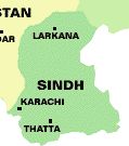 Sindh is the third largest province geographically with an area of 140,915 square kilometers. Balochistan province is to its west and north, Punjab in the north and Rajasthan (India) to the east. To the south are the Arabian Sea and the marshes of Rann of Kutch. Most of its population is urban and settled in Karachi (capital city), Hyderabad, Larkana, Thatta, Nawabshah, Mirpurkhas, Tando Adam, Tando Allahyar, Shikarpur and Sukkur. The province contains the southern part of the Indus River valley. In the east is the Thar Desert of India. Sindhi is the main language with widely spoken Urdu and Rajasthani (in some areas).
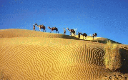
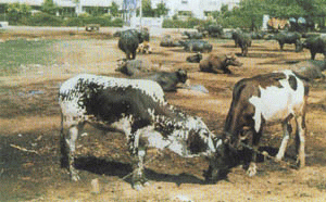
Although generally desert and semi desert, due to availability of water from a number of canals taken out from the Indus river, it has many cash crops like cotton, rice, wheat and sugarcane, with rice the most important. The Sindhi folklores narrate the rich Sindhi culture and its singers with their traditional instruments make the narrations more enchanting.
 Sindh traces its roots from the Indus Valley civilization of Mohenjodaro which existed some 3000 BC ago. In 1700 BC Aryans came to this part of the world and it was known that beyond Sindh in east was "Deserta inconeta" Unknown desert. In 325 BC Alexander the great conquered several cities and went westwards, hence even Alexander did not go beyond Sindh in the east. In 711 Muslims entered India via Sindh and conquered the city of Deebal (presently Bhambore). The arrival of Qasim was cue for the spread of Islam in the Indian sub-continent, that is why Sindh is known as Bab al Islam (the gateway of Islam). In 1842-1843 British forces under General Charles Napier conquered Sindh. The province was incorporated into Pakistan in 1947.

Left to Right: The famous blue stone of Hala artfully strewn in Hala Mosque - Birth Place of Emperor Akbar at Umerkot
Sind has a rich history which has been documented by Dr Paolo Biagi in his site Ancient Sind. Readers may find this site very informative and pictorial.
Punjab

The Land of Five Rivers
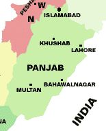
Punjab - or the Panj (Five), Aab (Waters / Rivers) - the land of five rivers (the Indus, Ravi, Chenab, Sutlej and Jhelum) is known for its lush green irrigated lands. Despite its generally dry climate, extensive irrigation by the river and canals makes it a rich agricultural region. Wheat and cotton are the largest crops. Other crops include rice, sugarcane, millet, corn, oilseeds, pulses, fruits, and vegetables. Livestock, poultry and fish production are account for its major produces. Its southern portion is however desert and semi desert including the Thar and Cholistan deserts. The remains of famous Drawar Fort in Cholistan desert still remind the visitors of its once majestic glory. Going purely by population, Punjab ranks first among the four provinces of Pakistan, while with 205,344 sq km, it ranks the second, after Balochistan. Punjab is part of the larger Punjab region, which is divided between India and Pakistan, known as East and West Punjab respectively. The Pakistani Punjab neighbours Sindh to the south, Balochistan and Federally Administered Tribal Areas to the west, North-West Frontier Province (NWFP) and Azad Kashmir to the north. According to the 1998 Census, the population of the province stands at 71.5 million (about 55% of the total population of Pakistan) compared with 47.12 million of 1981 population census figures. Population density in the province is 348 persons per square kilometre.
Punjab's economy is mainly agricultural, although industry makes a substantial contribution. The total geographic and reported areas are 20.66 and 16.30 million hectares respectively. 11.35 million hectares of the reported areas are under cultivation while 0.43 million hectares are under forests. Punjab commands one the largest canal irrigation systems of the world; 41.3 per cent of total cultivable land is irrigated solely by canals, while another 41.1 per cent by canal tube wells.
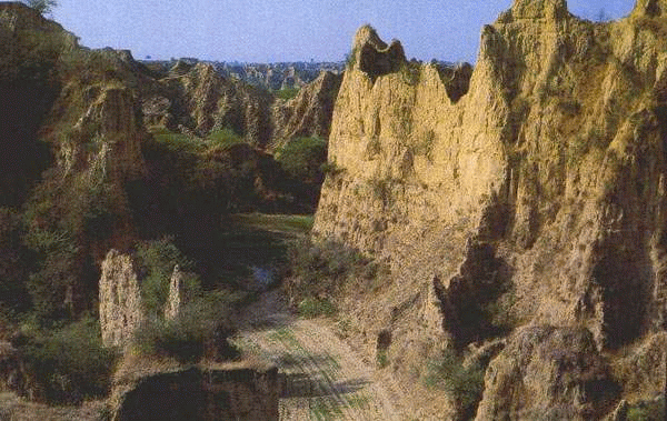
Left to Right: Grand Canyon replicated at Potwar Plateau - Cholistan Desert near Rahim Yar Khan
Punjab consists mostly of plains north and south of the ancient Salt Range, which runs from east to west. The Punjab can be divided into five major physical regions, such as the Northern Mountains, South-West Mountains, Pothwar Plateau, the Upper Indus Plain and the Deserts.
In the north, there are the outer ranges of the Himalayas: the Murree and Kahuta hills In the north and the Pubbi hills of Gujrat in the South.
In the southwest, there are the hills of the Sulaiman Range which, running from north to south in the D.G. Khan Division, are not higher than 1,200 meters and are dry and barren. The area across the Indus is also called "Derajat". On these rugged mountains, Fort Munro, Murree like hill station of southern Punjab is located.
The Pothwar Plateau (height 305 to 610 meters) has an area of 12,944 sq. km and is bounded by river Jhelum in the east and by Indus in the west. Covering virtually the whole of Rawalpindi Division, it extends to the northern slope of Kala Chitta Range and Margalla Hills and to the Salt Range in the south. It has deep ravines and slopes from northeast to southeast, a direction followed by Soan River. The Pothwar is the earliest proven oil-bearing region, now having most of the country's oilfields and has the country's first and the oldest oil refinery in Rawalpindi.
The Upper Indus Plain covering Lahore, Multan, Gujranwala and Faisalabad Divisions and large parts of Sargodha, D.G. Khan and Bahawalpur Divisions, is a feature-less terrain. With an average gradient of 19 c.m. to one c.m., it slopes gently to southeast.
To the southwest of Sutlej, there is a vast desert of about 2,592 million hectares of land covering about two-thirds of the entire Bahawalpur Division, divided into 'smaller' and 'greater' Cholistan, consisting of saline alluvial land with low dunes, ridges and depressions.
Lahore is the capital of Punjab, which has been the historical capital of the region. The major language spoken in the Punjab is Punjabi and Punjabis comprise the largest ethnic group. Once Sikhs dominated the Pakistani Punjab and many important Sikh shrines still exist including the birthplace of the Guru Nanak (born at Nankana Sahib). However, since partition, majority of the population is now Muslim.
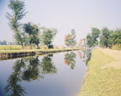
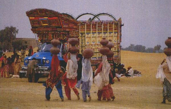
If one has to see the real Punjab, one must see its rural landscape and its indigenous people. Thriving villages along river and canal banks, living simple lives and livestock being their secondary earning resource. Farming booms in areas where river water reaches through an extensive network of canals. In fact the network of canals in Pakistan, particularly in Punjab is considered to be the largest in the world. As a consequence of the Indus Basin Water Treaty between India and Pakistan for sharing the water of rivers flowing in Pakistan from India, this network of canals was constructed for shifting of waters from one river to the other and facilitating provision of irrigation water. Areas where canal water cannot reach, has tube wells bored for which electricity is provided on concessional rates by the government.
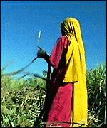
The people of Punjab are sturdy, men of soil, patriotic, hospitable and extremely hardworking.  Their day starts much before the sunset, when they move to their farms to water their crops. Women folk follow their males with breakfast consisting of "lassi" (made of yogurt and water with home breads and butter). although, mechanical means like tractor driven ploughs and crop cutters are finding their way into the rural life, but reliance on buffalo and oxen continues for ploughing, besides a means of obtaining milk. In the mornings, the elders also take their children to nearby village schools, since they do not want their off springs to remain illiterate and want them to become doctors and engineers. when the men are in the fields, women folk after doing the household chores, get together for a gossip and other "matters of common interest". The Punjabis are the backbone of the Pakistan Army and since the British days, a majority of the Punjabi youth in addition to the Pathans join the armed forces of the Pakistan to protect the frontiers of the country. The banner on the right is a British recruiting advertisement, which reads "Punjabi is a farmer during peacetime and a soldier during war. Most of the recipients of the Nishan-e-Haider, the highest gallantry military award of Pakistan hailed from the province of Punjab.
Besides agriculture, industry is also booming here, though mostly agro-based. The manufacturing industries produce textiles, machinery, electrical appliances, surgical instruments, metals, bicycles and rickshaws, floor coverings, and processed foods. The surgical appliances and sports goods are world acclaimed and many World Cup Football matches have the honour of using footballs made from Sialkot, Punjab. Beside Lahore, its other important cities and towns include Bahawalnagar, Bahawalpur, Faisalabad, Gujranwala, Multan, Rawalpindi, Sialkot, Sahiwal and small town but historically important Taxila and Harappa.
Music is imbued in the heart and blood of the people of Punjab. Not only men, horses and camels also dance to the beat of the drums. Classical music forms an important part of the cultural wealth of the Punjab. The Muslim musicians have contributed a vast number of ragas to the repertory of classical music and in compositions of classical ragas, there are such masters as Malika-I-Museequi (the queen of music) Roshan Ara Begum, Ustad Amanat Ali Khan, Ustad Salamat Ali Khan and world famous Late Ustad Fateh Ali Khan and Ustad Nusrat Fateh Ali Khan. For the popular taste, however, light music particularly ghazals and folk songs which have an appeal of their own, the names of late melody queen Noor Jahan and Malika Pukhraj stand out notably.
Folk songs and dances reflect a wide range of moods: the rains, sowing and harvesting seasons, 'Luddi', 'Jhoomer', ' Bhangrah', and 'Sammin' depict the joy of living. Love legends of Hir Ranjha, Mirza Sahiban, Sohni Mahenwal and Saiful Maluk are sung in different styles. Some of the folk singers have performed in many parts of the world and received acclaim and appreciation. Among the Punjab poets, the names of Sultan Bahu, Bulleh Shah and Mian Mohammad from yesteryears and folk singers like late Sain Marna and Tufail Niazi are well-known. After the death of renowned folk singer Alam Lohar, his son Asif Lohar has taken over the family's traditional "chimta style" singing, though mixed with modern instruments.
Balochistan - The Largest Land Mass Province
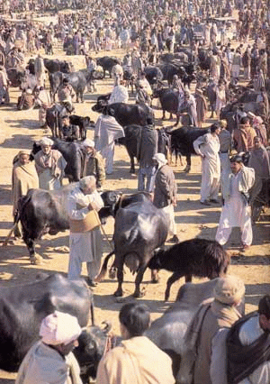
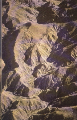
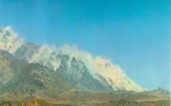
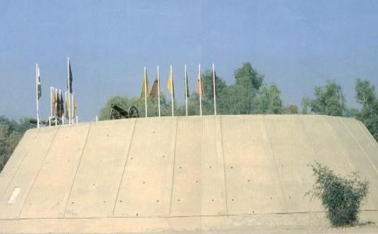
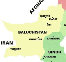 Balochistan - rugged with endless landscape (devoid of vegetation) - is the largest province of Pakistan. Like Punjab, it is also divided between Pakistan and Iran to the west. Besides Iran it neighbours Afghanistan and Federally Administered Tribal Areas (FATA) to the north and Punjab and Sindh to the east. To the south, its thirsty and perched dry vast lands of Makran skirt the Arabian Sea. Although it is the largest in area, some 347,190 square kilometres, it has the smallest population. The low population density is attributed to scarcity of water. Balochistan is located on a plateau in the west of Suleiman and Khirthar mountain ranges. Chaghi mountains separate Balochistan with Afghanistan. Many mountain passes connect Balochistan with Afghanistan, Bolan (below left) and Gomal passes being the noted ones. Balochistan traces its history as far back as 7000 BC when Mehrgarh farming settlements existed in this part of Pakistan. The atomic tests carried out by Pakistan in 1998 in the Chaghi mountains (below right) brought Balochistan in limelight. Quetta is the provincial metropolis and is an important and thriving trade centre.
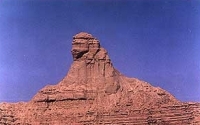
While Pakistan abounds in historical and natural features that attract the keen eyes of tourists the world over, an amazing feature was recently discovered (above centre), which resembles the Egyptian Sphinx on the coast of Makran along the Arabian Sea. Those visiting Balochistan and Makran Coast should not miss this great awe inspiring monument.
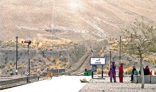
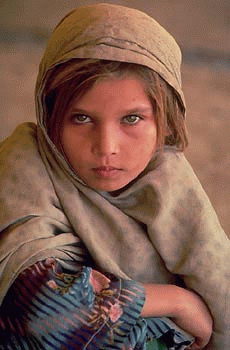
| Hirok station ,a remote place in Balochistan province is the only area around a hundred square kms ,where clean drinking water is available. These kids travel from their homes and cover almost 5 to 10 kms to reach here and fetch water in plastic cans and drums and carry a heavy load on their fragile shoulders. It is also noteworthy that the water source is not natural but only is supplied by trains from a relatively large station, nearby and filled in underground tanks. Sometime when the trains do not bring water it makes life more miserable for the people of the area and specially of these kids. Photo Courtesy: Commoner28th |
Balochistan has a population of around 7 million inhabitants. The Baloch numerically dominate the south of the province, while the Pashtuns are the majority in and around Quetta and the north. Near the Kalat region and other parts of the region the Brahui are a significant presence, while along the coast various Makrani peoples of mixed origins can be found such as the Meds and small groups of descendents of African slaves known as the Hupshi can also be found. Persian-speaking Dehwars also live in the Kalat region and further west towards the border with Iran. Some farmers from the adjacent Sind province have also settled in the arable lands in the east. Although a major portion of some 769,000 Afghan refugees has gone back to Afghanistan, their traces can still be felt in some areas.
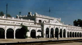
Above: Taftan Border Railway Station and Border Village at Pak-Iran Border
The only populated place in Balochistan is its capital city. Other important places are Chamman (on Afghan border), Zhob (previously Fort Sandeman), Kharan, Kohlu, Ziarat and Sui. Sui contains the biggest natural gas reservoir in Pakistan, which is meeting both the domestic and industrial needs of Pakistan. On its coast is located Sonmiani Beaches, some 40 km from Karachi and further west are the coastal areas of Ormarah, Pasni and Gwadar. Presently Gwadar is being developed into a port with Chinese help, which will serve CARs and Afghanistan in times to come.
Balochistan has many mineral resources including copper and gold, besides the natural gas. However, due to the possessive attitude of some of the tribal elders, not only these resources remain untapped, but the general development in the form of communication network and infrastructure, schools and agro-based industries have not been able to flourish. Presently, some of these tribal elders have taken up arms against the writ of the government and with hew help of some foreign countries making every effort to keep this area backward, underdeveloped so that their subjects remain subservient to them.
 However, the government is determined to bring in the winds of change. It is trying to educate the Balochi people so that they come forward and join hands with their other brethren to work for the progress and prosperity of the country. In last elections, Mrs Zubaida Jalal from remote Balochi village not only won a seat in the National Assembly of Pakistan, but has since been on various ministerial slots. Recently Sanhia Karim become the first Baloch woman to join the Pakistan Navy that now comprises a squad of around 53 women officers and 72 sailors. Sanhia says that she was impressed by the medical camp at Omara and observed that many of the technicians could not speak Balochi. It was then that she decided to join the Pakistan Navy as a female medical technician.
FATA of Pakistan
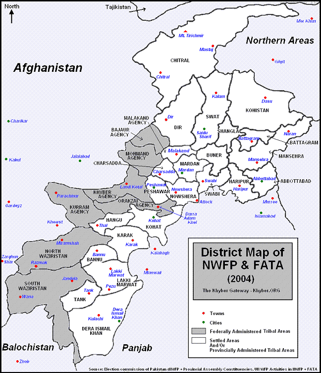
Federally Administered Tribal Areas (FATA) are areas independent of the four provinces of Pakistan, spread over some 27,220 sq km (10,507 sq miles). FATA neighbours Afghanistan to the west, NWFP to the north, Punjab to the east and Balochistan to the south. The total population of the FATA was estimated in 1998 to about 3 million. The FATA consists of five distinct areas: Khyber, Kurram, Malakand, Mohmand and Waziristan. The chief towns are Razmak, Miran Shah and Wana. The total population of the FATA as per a 2003 estimate is around 3,138,000, or roughly 2% of Pakistan's population. Only 2.7% of the population of the Tribal Areas resides in established towns. The economy of the FATA is chiefly pastoral, with some agriculture practiced in the region's few fertile valleys. Only 6.5 per cent of the area is cultivated with low cropping intensity and low yields. The literacy rate is 17 percent against 45 percent in Pakistan's settled areas and education is mostly restricted to males and only 3% female population is believed to receive some form of education. Its total irrigated land is 100,000 hectares.
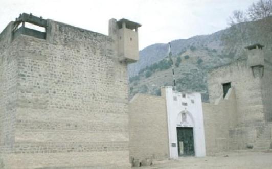
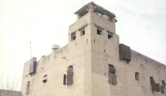
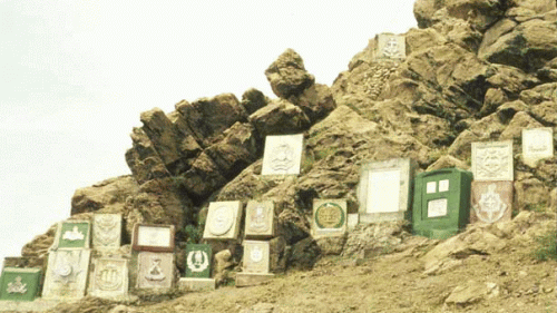
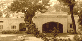
Frontier Constabulary's Forts at Bannu, Wanna and Miranshah
The administrative set-up of Khyber, Khurram, North and South Waziristan dates back to the time of British rule, while that of the other three agencies - Mohmand, Orakzai and Bajaur - and FRs was established after Independence in 1947. The autonomous status of FATA was accepted by Pakistan on its independence through the famous 'Instrument of Accession' signed by Quaid-i-Azam Mohammad Ali Jinnah at the Bannu Tribal Jirga in January 1948. The same was enshrined in all the constitutions of Pakistan. Under Article 247 of the Constitution, FATA comes under the executive authority of the Federation. Administratively, FATA enjoys a unique position whereby it is governed at the grassroots level through tribal representatives known as Maliks and Lungi Holders. There are a total of 3,616 Maliks and 3,441 Lungi Holders in FATA and FRs. A Malik/Lungi Holder is recognized by the government as a person commanding most authority and influence in his tribe, and is responsible for the maintenance of his respective area.
This area is composed of 11 major tribes and several sub-tribes such as Utman Khel, Tarkan, Mohmand, Safi, Afridi, Orakzai, Turi, Bangash, Dawar, Shelmani, Shinwari, Mulagori, Parachinar, Masozai, Saidgai, Mehsud, Waziris, Bhittani Kharasin, Gurbaz, Ustrana, Utmanzai, Ahmadzai and Shirani. The people of this area are largely Muslims, dotted with a very small population of Sikhs and Hindus. The language of all the tribes is Pashto, with softer dialects spoken in the south and harsher in the north.
Due to their system of governance and management, only 30 percent of FATA is inaccessible both politically and administratively as worked out by the British during the days of the British India. However, recently, for the first time since then, regular troops of Pakistan Army have been deployed and are operating along the Pak-Afghan border to check the movement of the militants into Pakistan. With the arrival of the army, new roads, schools, hospitals have been constructed and the accessibility to the rest of the country has considerably improved.
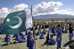
One of the number of schools established by Pakistan Army for enhancing education level in FATA
The areas constituting FATA have played an important role in the history of the subcontinent. The harsh and steep mountainous land interspersed with many passes, Khyber being the famous of all, has over the centuries been an easy gateway to invaders - Aryans, Turks, Mughals, White Huns, Durranis, Sythians, Tartars, Sassanians, Mongols, Seljuks and also Persians and Greeks. The British, realizing its strategic importance, demarcated this area as the buffer zone between the Indian Empire and Russia, against the threat of Tsarist expansion. This was done as part of Lord Curzon's 'Forward Policy'.
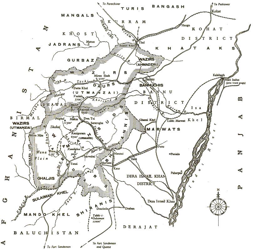
South Waziristan, the largest of the seven tribal agencies in FATA in terms of area, has always been difficult to govern. It is also one of the bigger agencies in terms of population and has, therefore, been given two seats in the country's national assembly as against one for most of the other tribal regions. South Waziristan is largely mountainous, dotted by forts built by the British in the early part of the last century in their largely unsuccessful colonial bid to crush the freedom struggle of the native tribes. The faqir of Ipi was a legendary freedom-fighter in Waziristan who, like several other clerics, exercised both religious and temporal power to inspire the tribesmen to fight the foreign forces of occupation. Pir Roshan, the most progressive religious figure in the whole tribal belt on the Afghanistan border, also belonged to present-day South Waziristan. Two Pashtoon tribes, Ahmadzai Wazir and Mahsud, inhabit and dominate South Waziristan. There are also some Burkis, a small ethnic group that has been assimilated by the Pashtoons and now mostly speaks the Pashtoo language. The Waziris live on both sides of the Durand Line that serves as a border between Afghanistan and Pakistan.
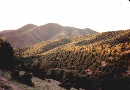
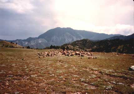
Mountainous South Waziristan - Prehgal Mountain (right) at 11,500 feet is the highest mountain in South Waziristan
Other Cities and Towns
Besides major metropolitan cities, a number of important cities and towns dot the map of Pakistan. Some have historic linkages, while others are important because of their location and peculiarities. In fact every place in Pakistan has a its own story to tell and its place in the history dating back thousands of years. Some of the these are listed below.

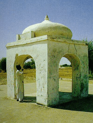
Tomb Bibi Jawandi - Uch (photo courtesy: Autumn Sun and Autumn Colours )
<="" b=""> Uch: At the confluence of the Sutlej and the Chenab is the historic town of Uch. HOW OLD IS THE UCH? No one knows but traces of Uch are found when Alexander the Great came to Uch after conquering the northern parts of India and spent over a fortnight in the city and renamed it Alexandria. That is why the town is often mentioned as Sikandara or Iskalanda. Uch is famous for shrines ornamented with blue mosaic like the ones in Multan.
<="" b="">  <="" b="">
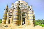
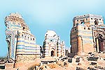
The famous shrines include those of Makhdoom Jahanian Jahangasht, Shaikh Saifuddin Ghazrooni and Bibi Jawandi. The tomb of Bibi Jawandi is the most completing, octagonal in shape, titled in the blue. For the reverence of great saints buried here, the town is respectfully named as Uch Shareef. Bibi Jawandi, the great granddaughter of the saint Jahaniyan Jahangasht, was known for her piety. Her tomb is considered one of the most important, and the most ornate, sites in the town of Uch, which was the centre of Sufism under the Delhi sultanate. In plan it is octagonal on the exterior, with the interior walls angled to form a circle. The thick walls rise to two stories, transforming by way of squinches into a sixteen-sided drum upon which a dome sits, supported by bell-shaped brackets. Both the interior and exterior walls are decorated with a profusion of faience revetment. The tomb is in poor condition. The tomb dates back to 1494 approximately.
<="" b=""> Thatta (or Thatto in local Sindhi language) - a town in Sind Province some 100 kms north of Karachi and west of the Indus River. Thatta has been the seat of Muslim rulers in Sind from 14th to 17th centuries. Thatta has a very rich heritage of Muslim architecture and the beautiful Shah Jahan Mosque, built by the constructor of Taj Mahal in 1647 A.D.
<="" b=""> 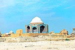 <="" b="">
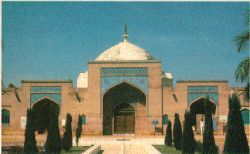
<="" b=""> <="" b=""> Mak<="" b="">li Necropolis (left) <="" b=""> Shah Jahan Mosque (right)<="" b="">
<="" b=""> Its exquisitely laid 93 domes in a mosaic of radiating blue and white tiles speak of the skilled craftsmanship of its own time. The Mak<="" b="">li Necropolis near Thatta is the world largest graveyard spread over 15.5 sq. kms, having millions of graves. There are monuments of Summa period (14th to 16th centuries), the Tarkhan & Arghun period (16th century), and the Mogul period (16th to 18th centuries).<="" b="">
<="" b=""> ![]() <="" b="">Hasan Abdal 48 km from Rawalpindi, is associated with Mughal and Sikhs. It was mentioned by Emperor Jehangir. A Mughal era remains of tomb of Lala Rukh is located here. The town takes its name from a 15th century saint Baba Wali Qandhari, popularly known as Baba Hasan Abdal who stayed in this area from 1406-1416 AD . His chamber, located on top of a 715 meter high hill is still visited by devotees. The famous Sikh holy shrine of Panja Sahib having a sacred rock with the hand print of their religious leader, Guru Nanak, makes Hasan Abdal famous for the Sikh community all over the world, who flock the area twice a year.
<="" b="">Hasan Abdal 48 km from Rawalpindi, is associated with Mughal and Sikhs. It was mentioned by Emperor Jehangir. A Mughal era remains of tomb of Lala Rukh is located here. The town takes its name from a 15th century saint Baba Wali Qandhari, popularly known as Baba Hasan Abdal who stayed in this area from 1406-1416 AD . His chamber, located on top of a 715 meter high hill is still visited by devotees. The famous Sikh holy shrine of Panja Sahib having a sacred rock with the hand print of their religious leader, Guru Nanak, makes Hasan Abdal famous for the Sikh community all over the world, who flock the area twice a year.
Gujranwala: Just an hour's drive from Lahore, lies the city of Gujranwala on the main Grand Trunk Road. After Lahore and Faisalabad, Gujranwala is the third largest city of the Punjab province, famous for grains, melons, sugarcane. The Gujranwala district is divided between a low alluvial tract along the river Chenab and Degh Nullah and the upland between these two, which forms the central portion of the Rechna Doab, intermediate between the fertile submontane plains of Sialkot and the desert expanses of Jhang. Part of the upland tract has been brought under cultivation by the Chenab canal. The city is known as the City of Pehelwaans (wrestlers) since it has produced some of the famous wrestlers of the subcontinent. People of this city are fond of eating and some of the best cooked dishes of Punjab like "Tikkas" "Chanps" "Kababs" are the hot favourites here. However "Chirays" (big sparrows special to Gujranwala) are a delicacy for which people even from Lahore and Rawalpindi throng Gujranwala's road side food shops. favourite places of the people.
District Office (Left) Railway Station (Right)
How old is this city anyway? Since all cities of Punjab have their long histories, so everyone asks about the same for Gujranwala. Not very old - just some 300-500 years old. The existence of small villages (now swelled into large size towns) like Eminabad, Ghakhar and Wazirabad around present day Gujranwala dates back to 16th century. The area comes to limelight during the Sikh rule of the Punjab, when the Sikhs established their Empire in the Punjab after the death of the Mughal Emperor Aurangzeb Alamgir in 1707. One Charat Singh, who was the head of one of the Sikh Clans, is said to have established his stronghold in Gujranwala in 1763. Charat Singh died in 1774 and was succeeded by his son, Mahan Singh, who in turn fathered the most brilliant leader in the history of the Punjab Maharaja Ranjit Singh. The British annexed the area in 1849. The Deputy Commissioner of that time Sir Bernardth rebuilt the "Sialkoti Gate" , "Lahore Gate" and "Khiyaaly Gate" in Gujranwala. A railway line was built along Grand Trunk Road, which interconnected Gujranwala with other cities of Punjab and made the commercial trade between cities more convenient. British ruled the city until Pakistan's independence in 1947.After Independence, most of the Hindu and Sikh residents of Gujranwala, or in fact from entire Punjab that came into Pakistan, moved migrated to India and Muslims migratees from India settled down in various areas of Punjab, including Gujranwala. Gujranwala was given the status of a district in 1951, which paved way for its progress and prosperity. Today, Gujranwala, besides its agro-based industry is also famous for manufacturing units / industries of ceramics, copper, brass, and aluminum utensils and iron safes. Sialkot and Gujranwala are also famous for producing world 's best quality Basmati rice. The Gujranwala hydroelectric project provides power from the Chenab River. Gujranwala is not far behind than Lahore, Faisalabad and Rawalpindi in holding international level cricket at the Jinnah Stadium, formerly known as Municipal Stadium.
Gilgit - Baltistan
(Northern Areas of Pakistan)
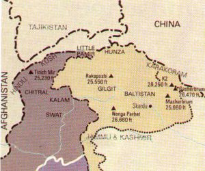
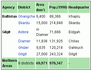
 Northern Areas of Pakistan consist of Gilgit - Baltistan region, sandwiched between the Hindukush and Karakoram on the north and western Himalaya on the south. It borders to the north with Afghanistan and China, to the south with India and Azad Kashmir and to the west with NWFP. The Northern Areas comprise the two districts of Baltistan and the three districts of Gilgit (where the capital is located). Hunza, an independent principality for 950 years which only came under Pakistani rule in 1974, is also located in this region. The Northern Areas collectively comprise a territory of some 72,496 sq km. The Northern Areas border the Wakhan corridor of Afghanistan to the northwest, the Xinjiang territory of China to the northeast, the Indian-controlled state of Jammu and Kashmir to the southeast, the region of Pakistani-administered Azad Kashmir to the southeast and the North-West Frontier Province to the west. The main political centres are the towns of Gilgit, Skardu and Chilas.
Once, the southern route of the ancient Silk Road passed through these areas, travelled by merchants from many far-off places who stopped here and inter-married with the locals. The relatively fair-skinned and light-haired people of the area are often believed to be the descendants of the Greeks who, beginning with the soldiers of Alexander the Great, and continuing in the Greco-Buddhist period, settled in the region. The population of these areas has links to many diverse linguistic, ethnic and religious groups. Urdu is the lingua franca of the region, understood by most inhabitants. The "Shina" language is the language of 40% of the population, spoken mainly in Gilgit, throughout Diamer, and some parts of Ghizer. The "Balti" language with a similar accent, is spoken or understood by most of the population of Baltistan. Other rather localised languages include "Wakhi" spoken in upper Hunza, and some villages in Ghizer, while Khowar is the major language of Ghizer. "Burushaski" is an isolated language spoken in Hunza, Nagar, Yasin (where Khowar is also spoken), some parts of Gilgit and some villages of Punyal. Another interesting language is Domaaki, spoken by the musician clans of the region.
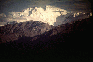
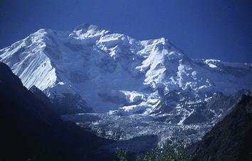
The region is home to some of the world's highest mountain ranges — the main ranges are the Karakoram and the western Himalayas. The Pamir mountains are to the north, and the Hindu Kush lies to the west. Five of the Eight-thousander (above 8,000m) peaks of the world are in the Northern Areas of Pakistan. Some of the world's largest glaciers outside the polar regions are also in Northern Areas, such as Baltoro Glacier, Biafo Glacier and Hispar Glacier. Amongst the highest mountains are K2 and Nanga Parbat, one of the most feared mountains in the world. The famous Karakoram Highway (KKH), the highest international road in the world, also pass through the NA to connect China with Pakistan through the Khunjrab pass, which is at an estimated altitude of 4850 meters. The pride pinnacles of the Northern Areas are:-
-
K2, 2nd highest of the world at 8,611Metres
-
Nanga Parbat, 9th highest of the world at 8,125 Metres
-
Gasherbrum I, 11th highest of the world at 8,080 Metres
-
Broad Peak, 12th highest of the world at 8,047 Metres
-
Gasherbrum II-IV, 13th-17th highest of the world at 8,035 Metres - 7,932 Metres
-
Masherbrum (K1), 22nd highest of the world at 7,821 Metres
-
Rakaposhi, 27th highest of the world at 7,788 Metres
Deosai Plains is located above the tree line, the second highest plains of the world at 4,115 m (13,500 feet) are in the South of Skardu and in the East of the Astore Valley. The area was declared as a National Park in 1993. The Deosai Plains cover an area of almost 3,000 square kilometers. The plains remain snow-bound for good about six months from November to May.
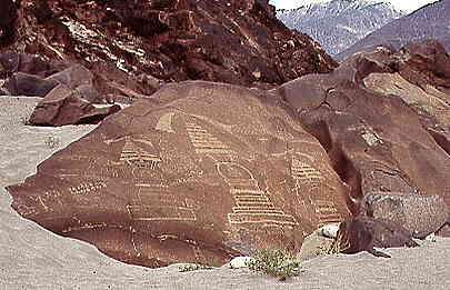
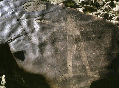
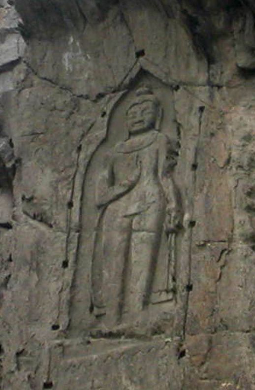
Left: Three stupas on the 'altar-rock' near Chilas (800 AD). Stupa in the middle is approximately 1 metre high. Right: Engravings on Rocks - KKH
There are more than 20,000 pieces of rock art and petroglyphs all along the Karakoram Highway in Northern Areas of Pakistan that are concentrated at ten major sites between Hunza and Shatial. The carvings were left by various invaders, traders and pilgrims who passed along the trade route, as well as by locals. The earliest date back to between 5000 and 1000 BCE, showing single animals, triangular men and hunting scenes in which the animals are larger than the hunters. These carvings were pecked into the rock with stone tools and are covered with a thick patina that proves their age.
Northern Areas Development Gateway (NADG) has been set up to enhance the access to development information related to Northern Areas of Pakistan. It is a pioneering web-based knowledge initiative presenting information on a range of issues pertaining to this region.
| The Gilgit-Baltistan Empowerment and Self Governance Order, 2009 approved by the federal cabinet on 29 August 2009, through which Pakistan officially granted full autonomy to the former Northern Areas. Ending their struggle for autonomy since 1947. Furthermore, the name of the Northern Areas was changed to "Gilgit Baltistan" has received mixed initial reactions. At least one change has been universally applauded though: renaming the Northern Areas Gilgit-Baltistan has met a long-standing demand of the people of the area who chafed under an appellation that was simply the geographical expression of the area's position vis-à-vis Jammu and Kashmir, i.e. the 'northern areas' of Jammu and Kashmir. But while the federal government and its allies have trumpeted the other changes to the administrative structure of Gilgit-Baltistan, the people of the area have been less than impressed. In fairness, the government deserves some credit for taking the step of recognizing that there is such a thing as Gilgit-Baltistan and moving to redress at least some of the local grievances against the system of governance and the delivery of justice. Yet, we are also sympathetic to the local claim that they are denied any clear constitutional status and the rights that would flow from it and the fact that the absence of a high court in Gilgit-Baltistan means the locals have to go to Islamabad to seek justice. Information Minister Qamar Zaman Kaira, who is also holding the charge of Minister for Kashmir Affairs and Northern Areas, and Minister of State for Information has also been named as the first governor of the Gilgit-Baltistan |
Gilgit
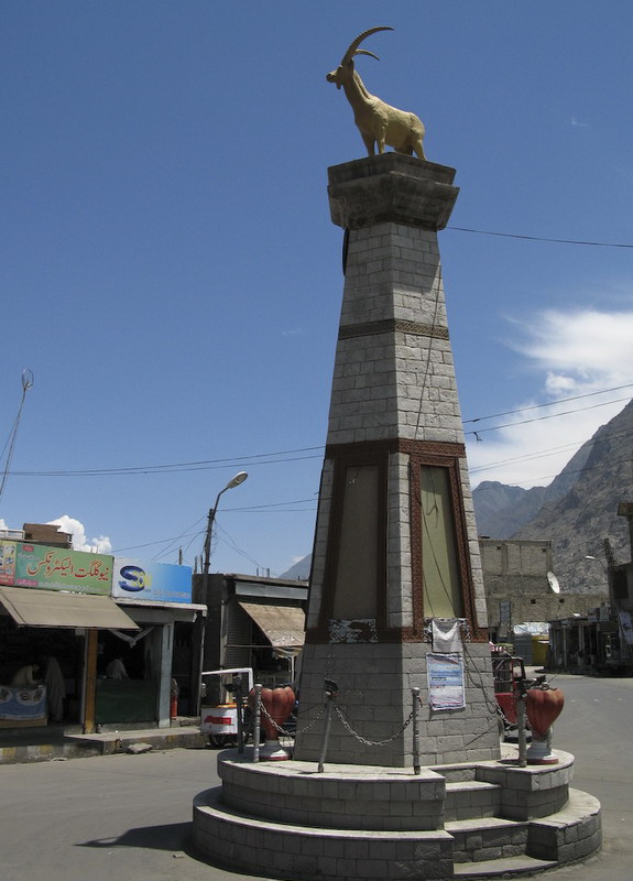
Budha's rock carving (left) - Gilgit Monument (right - Photo courtesy Karrar Haidri )
Located on the Karakoram Highway (KKH), the Eighth Wonder of the World, Gilgit is the most important city in the Northern Area of Pakistan. Gilgit provides the jump pad to some of the loftiest and mightiest pinnacles of the world and lush green valleys. It is also the biggest city after one crosses into Pakistan from China on KKH. It provides an insight into the so called Virgin Beauty of unexplored world.
Gilgit is the administrative capital of Northern Area Pakistan, consisted of six districts namely Ghezir, Gilgit, Diamar, Astore, Baltistan (Skardu) and Ghanche. Its ancient name was Sargin, later to be known as Gilit, and it is still called Gilit or Sargin-Gilit by local people, in the Burushaski language, it is named Geelt. Ghallata is considered its name in ancient Sanskrit literature. Gilgit city is one of the two major hubs on the Northern Areas for all mountaineering expeditions of Karakoram to the peaks of the Himalayas, the other hub being Skardu.
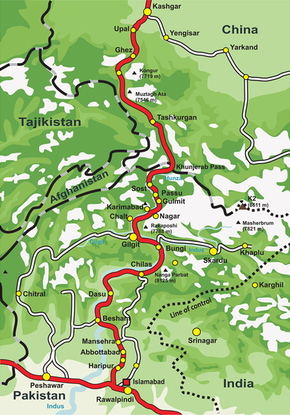 It is accessible by road and air from Islamabad. It has an area of 14,680 mi (38,021 km ). Gilgit lies about 10 km off the Karakoram Highway. The KKH connects it to Chilas, Dasu, Besham, Mansehra, Abbottabad and Islamabad in the south. In the North it is connected to Karimabad (Hunza) and Sust in the Northern Areas and to the Chinese cities of Tashkurgan, Upal and Kashgar in Xinjiang. The maximum temperature in May is 33 C and minimum 16 C In September. Gilgit is the gateway to China and Central Asia. Gilgit is also the hub of various valleys to the North Hunza and China. To the South, Diamar, Kohistan and Swat. To the East Skardu and Kashmir, and to the West Ghezir and Chitral. Shina is the language mainly spoken and understood in Gilgit Northern Area of Pakistan. Beside Shina people can speak and understand Urdu and English. Gilgit is well connected by air with Islamabad. You can take a flight to Gilgit from the capital of the country and reach Gilgit. The airport at Gilgit is just a mile away from the main bazaar and you can take mini-vans or some other vehicle to reach Gilgit town. Many tourists choose to travel Gilgit by air since the road travel between Islamabad and Gilgit by Karakoram Highway takes nearly 18 hours, whereas the air travel takes a mere 45-50 minutes. There are various transports companies i.e. Silk Route Transport Pvt, Mashabrum Transport Pvt and Northern Areas Transport Corporation (NATCO). But NATCO has vast coverage faciality. It offers passenger road service between Islamabad, Gilgit, Sust and Tashkurgan, and road service between Kashgar and Gilgit (via Tashkurgan and Sust) started in the summer of 2006. However, the border crossing between China and Pakistan at Khunjerab Pass (the highest border of the world) is open only between May 1 and October 15 of every year. During winter, the roads are blocked by snow. Even during the monsoon season in summer, the roads are often blocked due to landslides. The best time to travel on Karakoram Highway is spring or early summer.
The region is significantly mountainous, lying on the foothills of the Karakoram mountains, and has an average altitude of 1,500 m (5,000 ft). Gilgit city is one of the two major hubs for all mountaineering expeditions in the Northern Areas of Pakistan. For the sportive, one of the most interesting excursions is to Rakaposhi base camp. Rakaposhi is a 8-km giant. The peak tourist season is from May to mid-October though the tourist season is round the year.
Gilgit was an important city on the Silk Road through which Buddhism was spread from South Asia to the rest of Asia. A large number of Buddhist Sanskrit texts, included the long version of the Heart Sutra have been unearthed in Gilgit. The Dards and Cizinas also appear in many of the old Pauranic lists of peoples, with the former finding mention in Ptolemy's accounts of the region. Two famous travelers, Faxian, and Xuanzang are known to have traversed Gilgit as per their accounts."
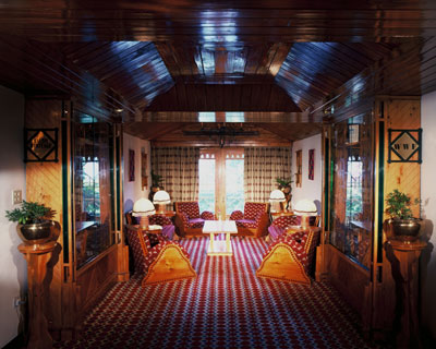
Chowk Yadgar (left- photo courtesy: Chiels at www.flickr.com ) - Gilgit Sarena Hotel (right)
Two miles out of town there are a pair of Buddha's carved in to a high rock. They go back to the 5-th century. It's a nice hike, the scenery on your way is gorgeous. Then there is a monument to commemorate the fact that the boy scouts of Gilgit were the spark that set the flame in the battle between Pakistan and India for supremacy over Kashmir. The beautiful valley of Naltar in the south eastern side of Gilgit is 35 km away from the main town. It's lush green pastures and green carpeted ground make it a jewel of the Gilgit. It is a forested (pine) village known for its wildlife and magnificent mountain scenery.
Mighty Rakaposhi (Photo courtesy Khalid Bukhari at pakistaniphotographer on www.flickr.com)
Important Places to visit around Gilgit include: Naltar, Hunza, Ferry Meadows (Raikot), Shigar (Skardu), Kutoval (Haramosh), Bagrote, Dev sai Plane (Astore), Rama (Astore), Gaasho Pahoot (Juglot Sai), Phunder, Yaseen Valley and Nagar Valley.
Over the years, Gilgit has become a mini China as its markets are over flooded with Chinese goods, specially China ware, rugs, cosmetics, crockery and decoration pieces. While it is a staging place for the traders who bring Chinese goods on buses and wagons from China, mostly from the Xinkiang province, it is a hub of shopping for tourists visiting Gilgit in summers.--
میرا نیا بلاگ - اپنی رائے کا اظہار کیجئے
http://shoaibtanoli.wordpress.com/
Regards
M Shoaib TaNoLi
Karachi Pakistan
Email@ shoaib.tanoli@gmail.com
Cell # +92-300-2591223
Facebook :https://www.facebook.com/mtanoli
SKYPE: shoaib.tanoli2
پاکستان زندہ باد ۔ پاکستان پائندہ باد
Long Live Pakistan
Pakistan Zindabad!
Dear Readers: My mails are my personal choice. The purpose of these mails is to establish contact with you, make you aware of different cultures ,disseminate knowledge and information. If these (mails) sound you unpleasant, please intimate .
IF YOU ARE NOT INTERESTED IN MY MAIL
PLEASE REPLY THIS E_,MAIL WITH THE SUBJECT.. UNSUBSCRIBE
E Mail: shoaib.tanoli@gmail.com
--
پاکستان کسی بھی پاکستانی کے لئے اللہ کی سب سے بڑی نعمتوں میں سے ایک ہے. آج ہم جو بھی ہے یہ سب اس وجہ پاکستان کی ہے ، دوسری صورت میں ، ہم کچھ بھی نہیں ہوتا. براہ مہربانی پاکستان کے لئے مخلص ہو.
* Group name:█▓▒░ M SHOAIB TANOLI░▒▓█
* Group home page: http://groups.google.com/group/MSHOAIBTANOLI
* Group email address MSHOAIBTANOLI@googlegroups.com
To unsubscribe from this group, send email to
MSHOAIBTANOLI+unsubscribe@googlegroups.com
*. * . * . * . * . * . * . * . * . * . *
*. * .*_/\_ *. * . * . * . * . * . * . * . * .*
.•´¸.•*´¨) ¸.•*¨) ¸.•´¸.•*´¨) ¸.•*¨)
(¸.•´ (¸.•` *
'...**,''',...LOVE PAKISTAN......
***********************************
Muhammad Shoaib Tanoli
Karachi Pakistan
Contact us: shoaib.tanoli@gmail.com
+923002591223
Group Moderator:
*Sweet Girl* Iram Saleem
iramslm@gmail.com
Face book:
https://www.facebook.com/TanoliGroups
No comments:
Post a Comment